Kandy City
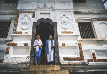
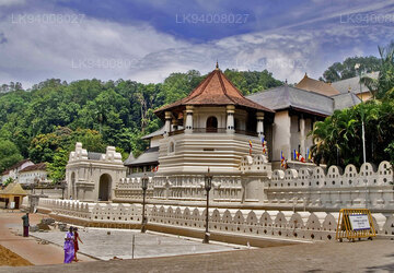
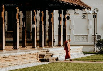
Kandy, a picturesque city in central Sri Lanka, is renowned for its rich cultural heritage, vibrant festivals, and scenic beauty. Nestled amidst lush hills, it is home to the Temple of the Tooth Relic, a UNESCO World Heritage Site, and offers a captivating blend of history and natural splendor.
Das letzte Königreich von Ceylon Kandy
Das Königreich Kandy war eine Monarchie auf der Insel Sri Lanka und lag im zentralen und östlichen Teil der Insel. Es wurde im späten 15. Jahrhundert gegründet und bestand bis ins frühe 19. Jahrhundert.
Kandy war zunächst ein Vasallenkönigreich des Königreichs Kotte und etablierte sich im turbulenten 16. und 17. Jahrhundert nach und nach als unabhängige Macht, die sich zu verschiedenen Zeiten mit dem Jaffna-Königreich, der Madurai-Nayak-Dynastie in Südindien, dem Sitawaka-Königreich und den niederländischen Kolonisatoren verbündete um sein Überleben zu sichern.
Ab den 1590er Jahren war es das einzige unabhängige einheimische Gemeinwesen auf der Insel Sri Lanka und hielt durch eine Kombination aus Fahrerflucht und Diplomatie die europäischen Kolonialkräfte in Schach, bevor es 1818 schließlich unter britische Kolonialherrschaft fiel.
Das Königreich wurde nach der Kandyan-Konvention von 1815 als Protektorat in das Britische Empire eingegliedert und verlor nach der Uva-Rebellion von 1817 endgültig seine Autonomie.
Im Laufe der Jahre war das Königreich Kandy unter vielen Namen bekannt.
- Kanda Uda Pasrata
- Das Senkadagala-Königreich
- Das Kanda Udarata
- Das Mahanuwara-Königreich
- Sri Wardhanapura
- Singhalesisch
- Thun Singhalesisch oder Tri Singhalesisch
- Kande Nuwara
- Das Königreich Kandy
Ein Großteil des Territoriums des Königreichs Kandy lag im bergigen und dicht bewaldeten Landesinneren Sri Lankas, und die Gebirgspässe zur Hauptstadt boten den Verteidigern zahlreiche Möglichkeiten für Hinterhalte. Die Wege in die Stadt wurden geheim gehalten, und die Verbreitung von Informationen darüber konnte oft zum Tod führen. Viele Wege ins Bergland wurden während des jährlichen Monsuns unpassierbar und Malaria war weit verbreitet. Während seiner gesamten Existenz nutzten die kandyischen Streitkräfte das Land zu ihrem Vorteil, führten einen Guerillakrieg gegen die Invasionstruppen[8] und evakuierten große städtische Zentren, wenn sich feindliche Truppen näherten – eine Taktik, die während der Kandy-Kriege besonders wirkungsvoll eingesetzt wurde. Obwohl das Königreich zeitweise Zugang zum Hafen von Batticaloa hatte, verfügte es über keine Seestreitkräfte und konnte die starke Präsenz der Portugiesen und Holländer in den Tieflandgebieten nicht verhindern.
Die Stadt Senkadagalapura wurde möglicherweise bereits Mitte des 14. Jahrhunderts während der Herrschaft von Vikramabahu III. von Gampola (1357–1374) gegründet. Zentral-Sri Lanka wurde vom frühen 15. bis zum späten 16. Jahrhundert von den Königen von Kotte regiert; Mit der Schwächung Kottes angesichts des portugiesischen Einflusses entwickelte sich das Gebiet zu einer autonomen Domäne mit Senkadagalapura als Hauptstadt. Nach der Zerstörung von Vijayabahu im Jahr 1521 und der anschließenden Teilung des Königreichs Kotte behauptete Kandy seine Unabhängigkeit und entwickelte sich zu einem ernsthaften Rivalen des östlichen und südlichen Königreichs.
About Kandy District
Kandy district is situated in the centrel province of Sri Lanka. One of the seven World Heritage Sites in Sri Lanka, Kandy was once home to the Kandyan Kings of yore in the 16th-century and a fountainhead for all the music, arts, crafts and culture in the country. About 129 km away from Colombo, Kandy is ensconced amongst a hilly terrain and all eyes are drawn to the centre of the city, where the Kandy Lake forms a charming feature. Kandy retains great religious significance for Sri Lanka, because it is in this charming city that the Dalada Maligawa or "Temple of the Tooth" is located, within which the sacred tooth relic of Lord Buddha lies well guarded.
The Royal Botanical Garden, Peradeniya is situated about 5 km to the west of the city centre at Peradeniya and is visited by 1.2 million people per year. It is the largest botanical garden on the island. The Udawatta Kele (Udawatta Forest) is a protected sanctuary situated in the heart of the city, just north of Temple of the Tooth.
Kandy is a Sinhala majority city; there are sizeable communities belonging to other ethnic groups, such as Moors and Tamils. Kandy is second only to Colombo the center of the Sri Lankan Economy. Many major co operations have large branch officers in Kandy and many industries include textiles, furniture, Information Technology and jewellery are found here. Many agriculture research centers are located in the city.
And a fountainhead for all the music, arts, crafts and culture in the country. About 129 km away from Colombo, Kandy is ensconced amongst a hilly terrain and all eyes are drawn to the centre of the city, where the Kandy Lake forms a charming feature. Kandy retains great religious significance for Sri Lanka , because it is in this charming city that the Dalada Maligawa or Temple of the Toothis located, within which the sacred tooth relic of Lord Buddha lies well guarded.
About Central Provincce
The Central Province of Sri Lanka consists primarily of mountainous terrain. The province has an area of 5,674 km², and a population of 2,421,148. Some major towns include Kandy, Gampola (24,730), Nuwara Eliya and Bandarawela. The population is a mixture of Sinhalese, Tamil and the Moors.
Both the hill capital Kandy and the city of Nuwara Eliya are located within the Central Province as well as Sri Pada. The province produces much of the famous Ceylon tea, planted by the British in the 1860s after a devastating disease killed all the coffee plantations in the province. Central Province attracts many tourists, with hill station towns such as Kandy, Gampola, Hatton and Nuwara Eliya. Temple tooth or Dalada maligawa is the main sacred place in Centrel province.
The climate is cool, and many areas about 1500 meters often have chilly nights. The western slopes are very wet, some places having almost 7000 mm of rain per year. The eastern slopes are parts of the mid-dry zone as it is receiving rain only from North-Eastern monsoon. The Temperatures range from 24°C at Kandy to just 16°C in Nuwara Eliya, which is located 1,889 m above sea level. The highest mountains in Sri Lanka are located in the Central Province. The terrain is mostly mountainous, with deep valleys cutting into it. The two main mountain regions are the central massif and the Knuckles range to the east of Kandy.


