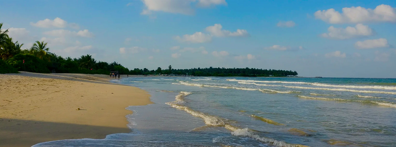
Kalkudah City
Kalkudah or Kalkuda is a coastal resort town located about 35 kilometers northwest of Batticaloa, Batticaloa District, Sri Lanka. Pasikudah and Kalkudah are located few kilometers apart.
Kalkudah
Kalkudah oder Kalkuda ist ein Küstenort, der etwa 35 Kilometer nordwestlich von Batticaloa, Batticaloa District, Sri Lanka liegt. Früher war es ein beliebtes Touristenziel, aber aufgrund des Tsunamis im Indischen Ozean 2004 und des Bürgerkriegs in Sri Lanka sind die Touristenzahlen zurückgegangen. Pasikudah und Kalkudah liegen nur wenige Kilometer voneinander entfernt.
Über Batticaloa District
Batticaloa ist eine Stadt in der östlichen Provinz Sri Lanka.Batticaloa liegt an der Ostküste Sri Lankas auf einer flachen Küstenebene, die im Osten vom Indischen Ozean begrenzt wird. Teil des östlichen Sri Lankas. Batticaloa liegt an der Ostküste, 314 km von Colombo entfernt. Die 515.707 Einwohner bestehen hauptsächlich aus Tamilen, Mauren, Singhalesen, euroasiatischen Bürgern (insbesondere portugiesischen Bürgern und niederländischen Bürgern) und indigene Bevölkerung der Vedda.
Reis und Kokosnüsse sind die beiden Grundnahrungsmittel des Bezirks, und Dampfer, die auf der Insel handeln, fahren regelmäßig im Hafen an. Die Lagune ist berühmt für ihre „singenden Fische“, die Muscheln sein sollen, die Musiknoten hervorbringen. Der Bezirk hat einen Rest von Veddahs oder wilden Männern des Waldes.
Die Stadt hat vier Hauptabteilungen
- Pullianthivu: Sitz vieler Regierungsabteilungen und Büros, Schulen, Banken, religiöser Stätten, Allgemeines Krankenhaus, Weber-Stadions und Geschäften. Heutzutage befinden sich auch viele NGO-Büros, darunter IKRK, UN, UNICEF, WORLD VISION usw.
- Koddamunai: Schulen, Banken, Sri Lanka Telecom Regionalbüro für Ost, Geschäfte und viele Regierungsstellen befinden sich. Zwei Brücken namens Perya Palam und Puthuppalam verbinden die Insel Pulianthivu mit der Landmasse von Koddaminai.
- Kallady: Hier gibt es viele Regierungsgebäude und private Industrien, Schulen, Krankenhäuser und die Medizinische Fakultät der Eastern University. Die Kallady Lady Manning Bridge (die längste Brücke in Sri Lanka) verbindet Kallady und Arasay.
- Puthur: Hier ist der Dom
Über die östliche Provinz
Die Ostprovinz ist eine der 9 Provinzen Sri Lankas. Die Provinzen existieren seit dem 19. Jahrhundert, hatten aber erst 1987 einen rechtlichen Status, als die 13. Änderung der Verfassung Sri Lankas von 1978 Provinzräte einrichtete. Zwischen 1988 und 2006 wurde die Provinz vorübergehend mit der Nordprovinz zur Nordostprovinz zusammengelegt. Die Hauptstadt der Provinz ist Trincomalee. Die östliche Provinz hatte 2007 1.460.939 Einwohner. Die Provinz ist die vielfältigste in Sri Lanka, sowohl ethnisch als auch religiös.
Dieöstliche Provinz hat eine Fläche von 9.996 Quadratkilometern (3.859,5 sq mi) .Die Provinz ist umgeben von der Nordprovinz im Norden, der Bucht von Bengalen im Osten, der Südprovinz im Süden und der Uva, Zentral- und Nördliche Zentralprovinzen im Westen. Die Küste der Provinz wird von Lagunen dominiert, von denen die größte die Batticaloa-Lagune, die Kokkilai-Lagune, die Upaar-Lagune und die Ullackalie-Lagune sind.
About Batticaloa District
Batticaloais a city in the Eastern province of Sri Lanka.Batticaloa is in the eastern coast of Sri Lanka on a flat coastal plain boarded by the Indian Ocean in the east occupies the central part of the eastern Sri Lanka. Batticaloa is on the East coast, 314 km from Colombo. The population of 515,707 consists mainly of Tamils, Moors, Sinhalese, Euro-Asian Burghers (specifically Portuguese Burghers and Dutch Burghers) and indigenous Vedda population.
Rice and coconuts are the two staples of the district, and steamers trading round the island call regularly at the port. The lagoon is famous for its "singing fish" supposed to be shell-fish which give forth musical notes. The district has a remnant of Veddahs or wild men of the wood.
The city has four main divisions
Pullianthivu: Seat of many government department and offices, schools, banks religious places, General Hospital, Weber Stadium and Shops. Nowadays many NGO offices including ICRC, UN, UNICEF, WORLD VISION etc.are located also.
Koddamunai: Schools, Banks,Sri Lanka Telecom regional office for East, Shops and many government offices are located. Two bridges called Perya Palam and Puthuppalam are connect Pulianthivu Island with Koddaminai land mass.
Kallady: Here there are many Government buildings and private industries, schools, hospitals and Eastern University Medical Faculty. Kallady Lady Manning Bridge (the longest bridge in Sri Lanka) connects Kallady and Arasay.
Puthur: This is where the dom
About Eastern Province
The Eastern Province is one of the 9 provinces of Sri Lanka. The provinces have existed since the 19th century but they didn't have any legal status until 1987 when the 13th Amendment to the 1978 Constitution of Sri Lanka established provincial councils. Between 1988 and 2006 the province was temporarily merged with the Northern Province to form the North-East Province. The capital of the province is Trincomalee. The Eastern province's population was 1,460,939 in 2007. The province is the most diverse in Sri Lanka, both ethnically and religiously.
Eastern province has an area of 9,996 square kilometers (3,859.5 sq mi).The province is surrounded by the Northern Province to the north, the Bay of Bengal to the east, the Southern Province to the south, and the Uva, Central and North Central provinces to the west. The province's coast is dominated by lagoons, the largest being Batticaloa lagoon, Kokkilai lagoon, Upaar Lagoon and Ullackalie Lagoon.


