Kandy City
Kandy, a picturesque city in central Sri Lanka, is renowned for its rich cultural heritage, vibrant festivals, and scenic beauty. Nestled amidst lush hills, it is home to the Temple of the Tooth Relic, a UNESCO World Heritage Site, and offers a captivating blend of history and natural splendor.
Galaha
Galaha ist eine kleine Stadt im Zentrum Sri Lankas. Es liegt auf einer Höhe von etwa 700 Metern (2.300 Fuß) und ist eines der ersten Teeanbaugebiete in Sri Lanka, 20 Kilometer (12 Meilen) südlich von Kandy. Und 19 Kilometer (12 Meilen) von der Stadt Gampola und 5 Kilometer (3,1 Meilen) von der Stadt Deltata entfernt.
Derzeit wird es vom Deltata-Divisionssekretariat und Patahewaheta Pradeshiya Sabah verwaltet.
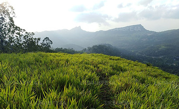
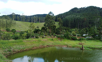
Galaha ist ein Berggebiet mit grünen Hügeln und natürlichen Wasserquellen. Es ist eine kalte und regnerische Gegend. Ein kleiner Fluss umgibt das Gebiet und versorgt die Bauern, die in dieser Region Reis anbauen, mit ausreichend Wasser. In Sri Lanka ist dies ein solcher Ort, an dem seit mehreren Jahrhunderten schrittweise Reisanbau betrieben wird. Diese Stadt ist von Bergen umgeben, deren oberster Boden durch heftige Regenfälle und den Anbau erodiert ist. Und so hat das Wiederaufforstungsprogramm der Regierung auf ihnen wunderschöne Kiefernwälder geschaffen. Es gab mehrere Teeplantagen, als die gewinnbringende Industrie in dieser Gegend verschwand. Die nächstgelegene Teefabrik, Galaha Group, eine der größten Fabriken, liegt am Ortseingang, ist verlassen und wurde nie restauriert. Natürliche Mineralien wie Quarz und Glimmer sind in den umliegenden Bergen reichlich vorhanden. Daher gibt es in dieser Stadt keine Gästehäuser/Unterkünfte, es gibt jedoch einen schönen Ferienort in der Nähe von Nillambe, sechs Kilometer entfernt. Diese Stadt hat eine Vihara, einen Hindu-Tempel, eine Moschee und eine Kirche.
Diese Stadt bietet ihren Bewohnern alles. Gegenüber liegen eine Tankstelle und ein Restaurant. Es gibt auch ein gut gepflegtes Regierungskrankenhaus. Die Wirtschaft dieses Ortes hängt von den Arbeitsplätzen im Nahen Osten, der Landwirtschaft, Regierungsstellen und der Wirtschaft ab.
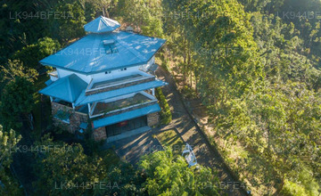
Bemerkenswerte Orte in der Nähe der Stadt sind das Badrawathi-Krankenhaus für buddhistische Mönche, der Tempel und der heilige Berg, das Meditationszentrum in Nillambe, der Rosa Thiruwana-Felsen, Belwood Saundarya nikethanaya, die 1. Teeplantage Sri Lankas, das Loolkandura Estate, das Forest and Sir James Taylor Tea Museum und das Bergriff.
About Kandy District
Kandy district is situated in the centrel province of Sri Lanka. One of the seven World Heritage Sites in Sri Lanka, Kandy was once home to the Kandyan Kings of yore in the 16th-century and a fountainhead for all the music, arts, crafts and culture in the country. About 129 km away from Colombo, Kandy is ensconced amongst a hilly terrain and all eyes are drawn to the centre of the city, where the Kandy Lake forms a charming feature. Kandy retains great religious significance for Sri Lanka, because it is in this charming city that the Dalada Maligawa or "Temple of the Tooth" is located, within which the sacred tooth relic of Lord Buddha lies well guarded.
The Royal Botanical Garden, Peradeniya is situated about 5 km to the west of the city centre at Peradeniya and is visited by 1.2 million people per year. It is the largest botanical garden on the island. The Udawatta Kele (Udawatta Forest) is a protected sanctuary situated in the heart of the city, just north of Temple of the Tooth.
Kandy is a Sinhala majority city; there are sizeable communities belonging to other ethnic groups, such as Moors and Tamils. Kandy is second only to Colombo the center of the Sri Lankan Economy. Many major co operations have large branch officers in Kandy and many industries include textiles, furniture, Information Technology and jewellery are found here. Many agriculture research centers are located in the city.
And a fountainhead for all the music, arts, crafts and culture in the country. About 129 km away from Colombo, Kandy is ensconced amongst a hilly terrain and all eyes are drawn to the centre of the city, where the Kandy Lake forms a charming feature. Kandy retains great religious significance for Sri Lanka , because it is in this charming city that the Dalada Maligawa or Temple of the Toothis located, within which the sacred tooth relic of Lord Buddha lies well guarded.
About Central Provincce
The Central Province of Sri Lanka consists primarily of mountainous terrain. The province has an area of 5,674 km², and a population of 2,421,148. Some major towns include Kandy, Gampola (24,730), Nuwara Eliya and Bandarawela. The population is a mixture of Sinhalese, Tamil and the Moors.
Both the hill capital Kandy and the city of Nuwara Eliya are located within the Central Province as well as Sri Pada. The province produces much of the famous Ceylon tea, planted by the British in the 1860s after a devastating disease killed all the coffee plantations in the province. Central Province attracts many tourists, with hill station towns such as Kandy, Gampola, Hatton and Nuwara Eliya. Temple tooth or Dalada maligawa is the main sacred place in Centrel province.
The climate is cool, and many areas about 1500 meters often have chilly nights. The western slopes are very wet, some places having almost 7000 mm of rain per year. The eastern slopes are parts of the mid-dry zone as it is receiving rain only from North-Eastern monsoon. The Temperatures range from 24°C at Kandy to just 16°C in Nuwara Eliya, which is located 1,889 m above sea level. The highest mountains in Sri Lanka are located in the Central Province. The terrain is mostly mountainous, with deep valleys cutting into it. The two main mountain regions are the central massif and the Knuckles range to the east of Kandy.


