Pattipola
Über Pattipola
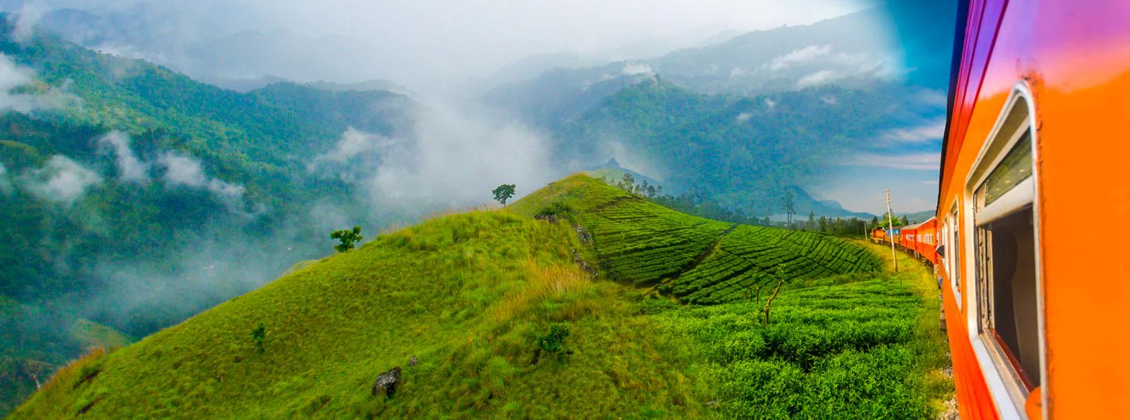
Pattipola ist eines der schönsten Dörfer Sri Lankas mit seiner spektakulären Hochebene und liegt in der Zentralregion. Die Hauptstadt Kandy liegt etwa 113 km von Pattipola entfernt. Die Entfernung von Pattipola zur Sri Lankas Hauptstadt Colombo beträgt etwa 224 km.
Erreichen Sie Pattipola
Die Menschen können die Hauptautostraße von Colombo aus sowie die Hochlandbahnlinie von Colombo zum Bahnhof Pattipola erreichen.
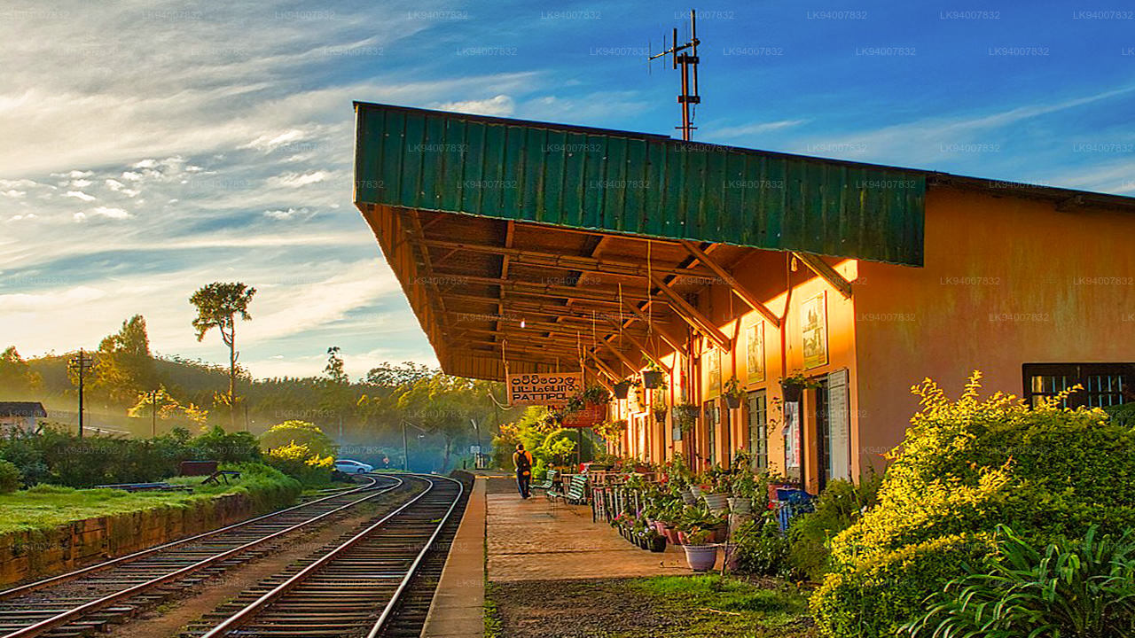
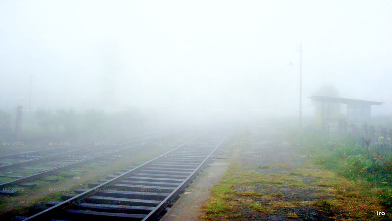
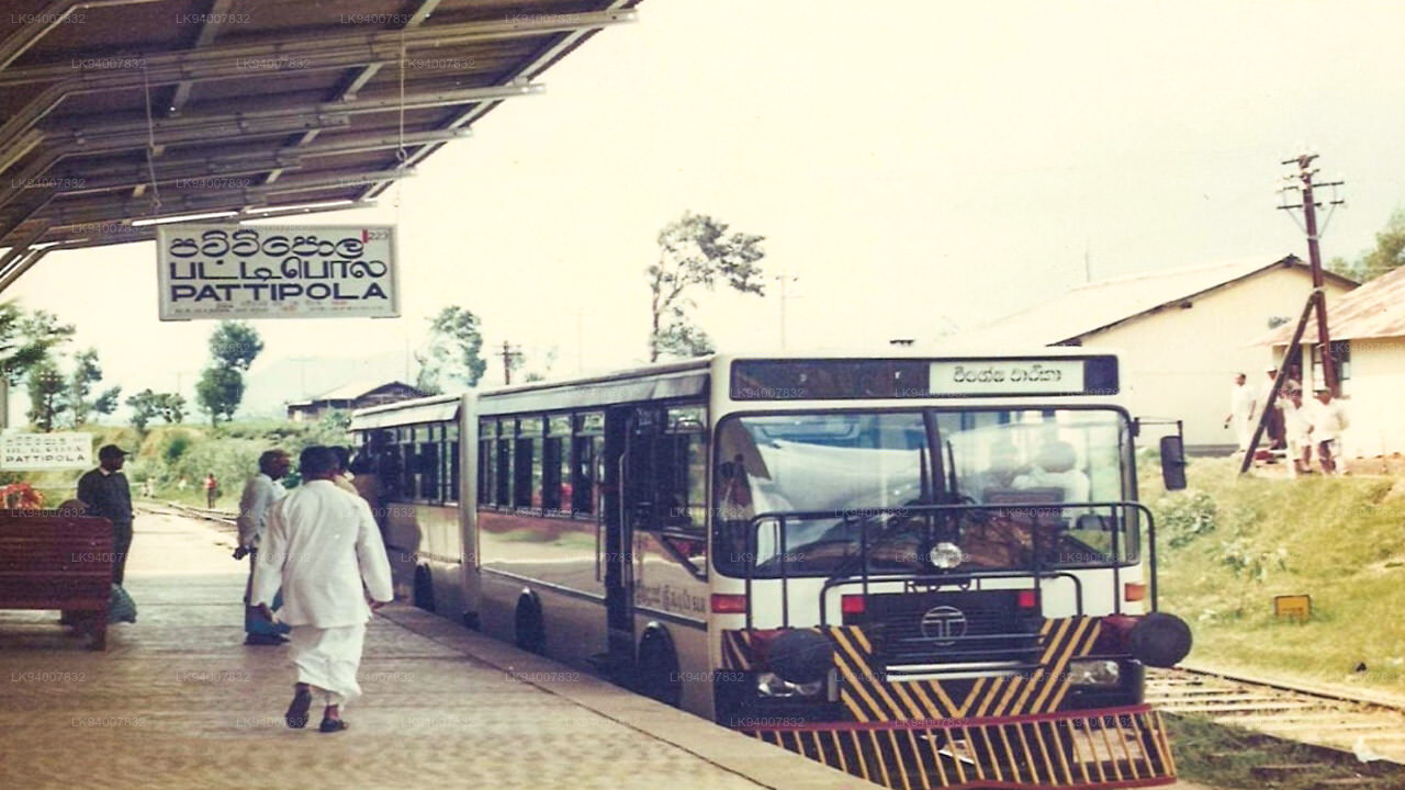
Bahnhof Pattipola
Der Bahnhof Pattipola ist einer der berühmtesten Bahnhöfe Sri Lankas, 224 km von der Festung Colombo entfernt und zwischen dem Bahnhof Ambewela und dem Bahnhof Ohiya an der Hauptstrecke im Bezirk Nuwara Eliya in der Zentralprovinz gelegen. Außerdem ist er der höchstgelegene Bahnhof in Sri Lanka Sri Lanka mit einer Höhe von 1.897,5 m (6.225 ft) hoch über dem mittleren Meeresspiegel. Der Bahnhof Pattipola ist der 62. Bahnhof auf der Hauptstrecke und liegt 224 km (139 Meilen) von Colombo entfernt. Der Bahnhof verfügt über einen Bahnsteig und einen zweiten Gleis als Abstellgleis. Alle Züge, die auf der Hauptstrecke verkehren, einschließlich der Expresszüge Podi Menike und Udarata Menike, halten am Bahnhof.
Ausflüge von Pattipola
- Hortain Plains (6 km)
- Botanischer Garten Hakgala (14 km)
- Hakgala-Gebirge (14 km)
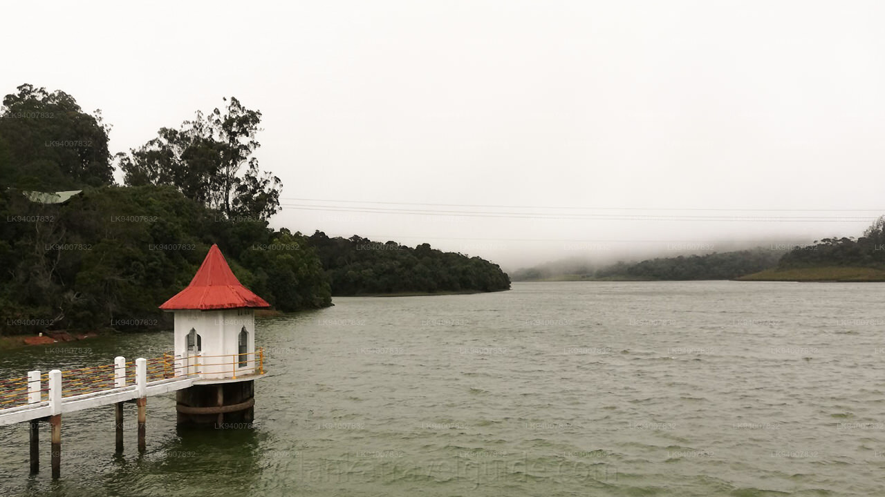
- Kande Ela-Stausee (12 km)
- Konischer Hügel (16 km)
- Naturschutzgebiet Hakgala (11 km)
Über den Bezirk Nuwara Eliya
Nuwara Eliya ist eine Stadt in der Zentralprovinz Sri Lankas. Es liegt auf einer Höhe von 1.868 m (6.128 ft) im zentralen Hochland und gilt als einer der wichtigsten Standorte für die Teeproduktion in Sri Lanka . Die Stadt wird vom Pidurutalagala , dem höchsten Berg Sri Lankas, überragt.
Aufgrund der Höhenlage herrscht in Nuwara Eliya ein viel kühleres Klima als im Tiefland Sri Lankas mit einer durchschnittlichen Jahrestemperatur von 16 °C. Aber die Temperatur schwankt und kann manchmal bis zu 3°C betragen. In den Wintermonaten ist es nachts recht kalt, es kann sogar Frost geben. Allerdings wird es schnell wärmer, wenn die tropische Sonne im Laufe des Tages höher steigt.
Singhalesisch und Tamil sind die Hauptsprachen, die in Nuwara Eliya gesprochen werden. Die Bevölkerung ist eine Mischung aus Singhalesen, Tamilen und Mauren. Viele Teeplantagenarbeiter sind indische Tamilen, die im 19. Jahrhundert von den Briten nach Sri Lanka gebracht wurden.
Über die Zentralprovinz
Die Zentralprovinz Sri Lankas besteht hauptsächlich aus bergigem Gelände. Die Provinz hat eine Fläche von 5.674 km² und eine Bevölkerung von 2.421.148. Zu den größeren Städten zählen Kandy , Gampola (24.730), Nuwara Eliya und Bandarawela . Die Bevölkerung ist eine Mischung aus Singhalesen, Tamilen und Mauren.
Sowohl die Berghauptstadt Kandy als auch die Stadt Nuwara Eliya liegen in der Zentralprovinz sowie in Sri Pada. Die Provinz produziert einen Großteil des berühmten Ceylon-Tees , den die Briten in den 1860er Jahren anpflanzten, nachdem eine verheerende Krankheit alle Kaffeeplantagen in der Provinz zerstört hatte. Die Zentralprovinz lockt mit Bergstädten wie Kandy, Gampola, Hatton und Nuwara Eliya viele Touristen an. Der Zahntempel oder Dalada Maligawa ist der wichtigste heilige Ort in der Provinz Centrel .
Das Klima ist kühl und in vielen Gegenden um 1500 Meter sind die Nächte oft kühl. Die Westhänge sind sehr nass, stellenweise fallen fast 7000 mm Regen pro Jahr. Die Osthänge sind Teile der mitteltrockenen Zone, da es nur vom Nordostmonsun regnet. Die Temperaturen reichen von 24°C in Kandy bis zu nur 16°C in Nuwara Eliya, das 1.889 m über dem Meeresspiegel liegt. Die höchsten Berge Sri Lankas liegen in der Zentralprovinz. Das Gelände ist größtenteils gebirgig und weist tiefe Täler auf. Die beiden Hauptgebirgsregionen sind das Zentralmassiv und die Knuckles-Bergkette östlich von Kandy .
Special places in Badulla
-
 Muthiyangana Raja Maha Vihara
Muthiyanganaya Raja Maha Viharaya lies in the centre of the city of Badulla. The History of this temple goes back to the time of Buddha but this area around Badulla goes way back in to the time of 19th -18th century BCE.
-
 Dowa Raja Maha Viharaya
Dowa Raja Maha Viharaya (Dowa Cape Temple) lies few kilometres away from the Bandarawela town on the Bandarawela – Badulla Road. This temple is thought to be done by King Walagamba in the in first century BC.
-
 Bogoda Wooden Bridge
The Bogoda Wooden Bridge was built in the 16th century during the Dambadeniya era. This is said to be the oldest surviving wooden bridge in Sri Lanka. The bridge is situated at 7 kilometres (4.3 mi) west of Badulla.
-
 Dunhinda Falls
Dunhinda Falls is situated about 5 km away from Badulla town. It is 63 meters high and is considered to be one of the most beautiful waterfalls in Sri Lanka. The falls gets its name dew to the smoky dew drops spray.


