
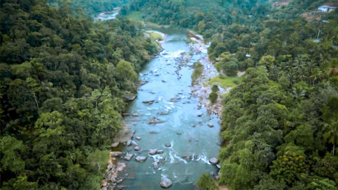
Kelani-Fluss (කැලණි ගඟ)
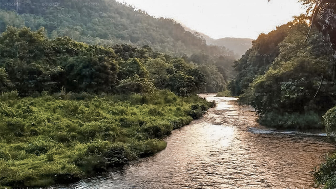
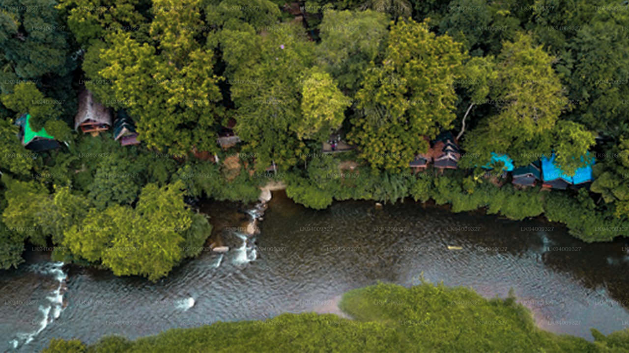
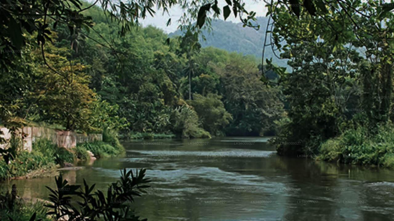
Der Kelani River ist ein 145 Kilometer langer Fluss in Sri Lanka. Er gilt als viertlängster Fluss des Landes und erstreckt sich vom Sri Pada-Gebirge bis nach Colombo. Er fließt durch oder grenzt an die srilankischen Distrikte Nuwara Eliya , Ratnapura, Kegalle , Gampaha und Colombo. Der Kelani-Fluss fließt auch durch die Hauptstadt Sri Lankas , Colombo, und liefert 80 % des Trinkwassers. Der Kelani-Fluss hat in seinem Oberlauf zwei Hauptzuflüsse: den Kehelgamu Oya und den Maskeli Oya. Diese beiden tragen zur Wasserkraftproduktion in Sri Lanka bei und beherbergen mehrere große Stauseen, Teiche und Kraftwerke. Castlereigh Reservoir und Norton Reservoir werden auf der anderen Seite des Kehelgamu Oya gebaut, während Maskeliya Reservoir, Canyon Reservoir und Laxapana Reservoir auf der anderen Seite der Maskeli Oya gebaut werden. In seinem Unterlauf münden einige weitere Nebenflüsse in den Kelani-Fluss, von denen die bekanntesten der We Oya bei Yatiyanthota, der Gurugoda Oya bei Ruwanwella und der Seethawaka Ganga bei Avissawella sind.
Der Kelani liefert etwa 80 % des in Colombo verbrauchten Wassers. Darüber hinaus wird der Fluss für den Transport, die Fischerei, den Sandabbau und die Erzeugung von Wasserkraft genutzt. Aufgrund dieser Faktoren sind viele Menschen für ihren Alltag auf den Fluss angewiesen. Derzeit sind die beiden Hauptsorgen im Zusammenhang mit dem Fluss Überschwemmungen während des Monsuns und das Eindringen von Salzwasser in der Trockenzeit. Darüber hinaus beeinflusst der Wasserstand des Kelani-Flusses das Überschwemmungsrisiko in Colombo, der Hauptstadt Sri Lankas , erheblich. Ein Grund dafür ist, dass ein Teil der Stadt und der Vororte von Colombo in der unteren Überschwemmungsebene des Flusses liegt. Ein weiterer Grund ist, dass Colombo und die oberen Einzugsgebiete des Kelani-Flusses dem Südwestmonsun ausgesetzt sind.
Die Probleme hängen zusammen: Der Salzeintrag wird durch die durch den Sandabbau verursachte Vertiefung des Flusses verstärkt. Regulierungen zur Verhinderung des Eindringens von Salzsäure können die Wasserqualität auf andere Weise verringern und das Überschwemmungsrisiko erhöhen. Der Sandabbau ist national und für die vielen Beteiligten wirtschaftlich wichtig. Der Kelani-Fluss ist eng mit der singhalesisch- buddhistischen Kultur Sri Lankas verbunden, insbesondere mit den Menschen, die in dem als Kelani-Tal bezeichneten Gebiet leben. Dies ist in erster Linie auf die Tatsache zurückzuführen, dass der Fluss Kelani mit zwei der am meisten verehrten buddhistischen Schreine und Pilgerstätten verbunden ist, nämlich dem Berg Sri Pada und dem Kelani Raja Maha Viharaya.
-
 Malwathu Oya (මල්වතු ඔය)
The Malvathu River long river in Sri Lanka, connecting the city of Anuradhapura, which was the capital of the country for over 15 centuries, to the coast of Mannar. It currently ranks as the second longest river in the country, with a great historic significance.
-
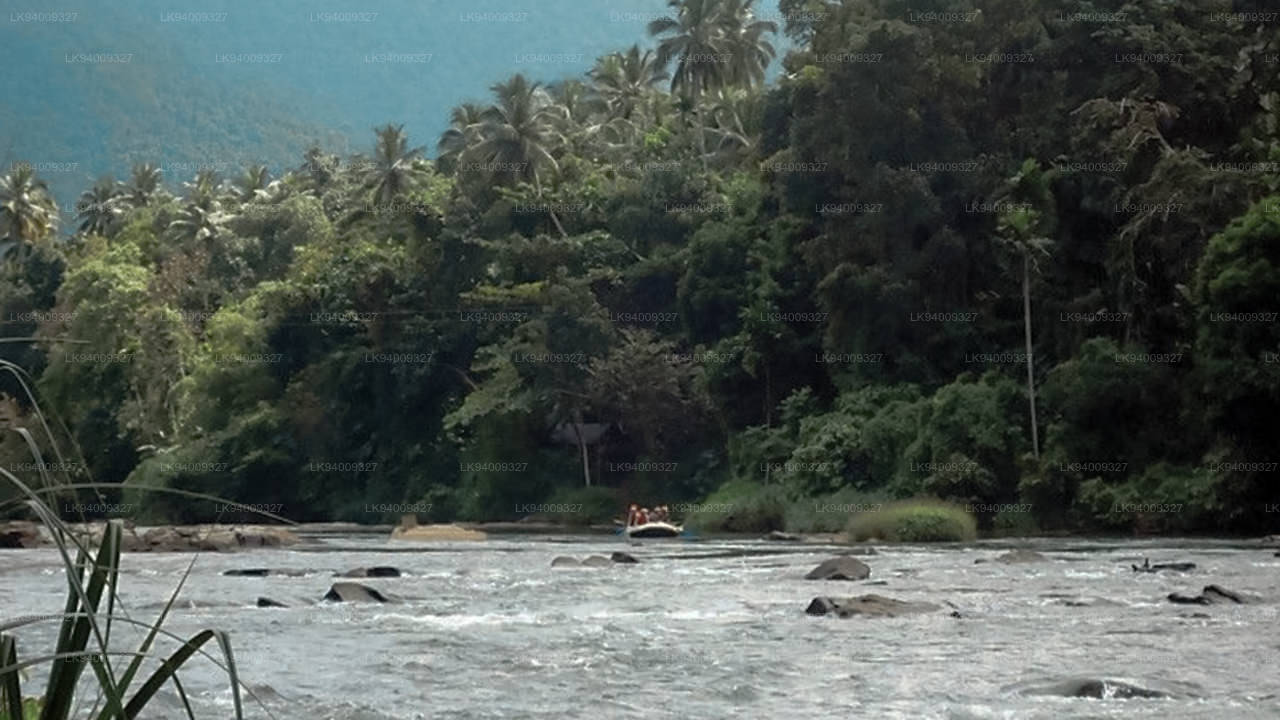
 Kelani River (කැලණි ගඟ)
The Kelani River is a 145-kilometre-long (90 mi) river in Sri Lanka. Ranking as the fourth-longest river in the country, it stretches from the Sri Pada Mountain Range to Colombo. It flows through or borders the Sri Lankan districts of Nuwara Eliya, Ratnapura, Kegalle, Gampaha and Colombo.
-
 Yan Oya (යාන් ඔය)
The Yan Oya is the fifth-longest river of Sri Lanka. It measures approximately 142 km (88 mi) in length. Its catchment area receives approximately 2,371 million cubic metres of rain per year, and approximately 17 percent of the water reaches the sea. It has a catchment area of 1,520 square kilometres.
-
 Walawe River (වලවේ ගඟ)
The southern region of Sri Lanka is exalted by a bushel of enthralling and glorified rivers and the Walawe River is one of them. Gently flowing through the Udawalawe National Park, the Walawe River provides water for a multitude of species of mesmerising fauna.
-
 Kalu Ganga (කළු ගඟ)
Kalu Ganga is a river in Sri Lanka. Measuring 129 km (80 mi) in length, the river originates from Sri Padhaya and reach the sea at Kalutara. The Black River flows through the Ratnapura and the Kalutara District and pass the city Ratnapura. The mountainous forests in the Central Province and the Sinharaja Forest Reserve are the main sources of water for the river.
-
 Maha Oya (මහ ඔය)
The Maha Oya is a major stream in the Sabaragamuwa Province of Sri Lanka. It measures approximately 134 km (83 mi) in length. It runs across four provinces and five districts. Maha Oya has 14 Water supply networks to serve the need of water and more than 1 million people live by the river.
-
 Gin Ganga (ගිං ගඟ)
The Gin Ganga, is a 115.9 km (72 mi) long river situated in Galle District of Sri Lanka. The river's headwaters are located in the Gongala Mountain range, near Deniyaya, bordering the Sinharaja Forest Reserve.
-
 Kala Oya (කලා ඔය)
It was around these ancient tank (water storage reservoir) irrigation systems that the economy and human settlements of early Sri Lankan society were organised into a “hydraulic civilization”.
-
 Deduru Oya (දැදුරු ඔය)
The Deduru Oya Dam is an embankment dam built across the Deduru River in Kurunegala District of Sri Lanka. Built in 2014, the primary purpose of the dam is to retain approximately a billion cubic metres of water for irrigation purposes, which would otherwise flow out to sea.
-
 Maduru Oya (මාදුරු ඔය)
The Maduru Oya is a major stream in the North Central Province of Sri Lanka. It is approximately 135 km (84 mi) in length. Its catchment area receives approximately 3,060 million cubic metres of rain per year, and approximately 26 percent of the water reaches the sea.
-
 Kumbukkan Oya (කුඹුක්කන් ඔය)
The Kumbukkan Oya is the twelfth-longest river of Sri Lanka. It is approximately 116 km (72 mi) long. It runs across two provinces and two districts. Its catchment area receives approximately 2,115 million cubic metres of rain per year, and approximately 12 percent of the water reaches the sea.
-
 Mi Oya (මී ඔය)
The Mi oya is a 108 km (67 mi) long river, in North Western of Sri Lanka. It is the fifteenth-longest river in Sri Lanka. It begins in Saliyagama and flows northwest, emptying into the Indian Ocean thru Puttalam.


