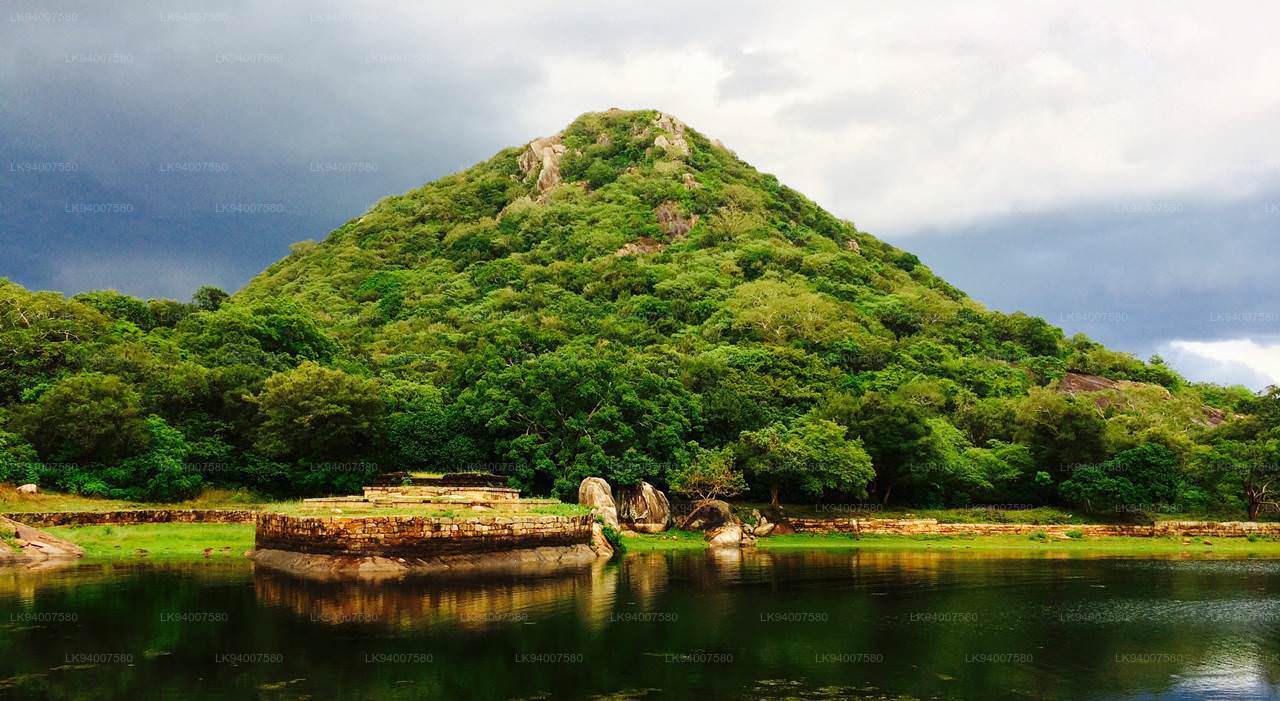
Kaludiya Pokuna Wald

Kaludiya Pokuna-Komplex Kaludiya Pokuna-Komplex Kaludiya Pokuna-Komplex

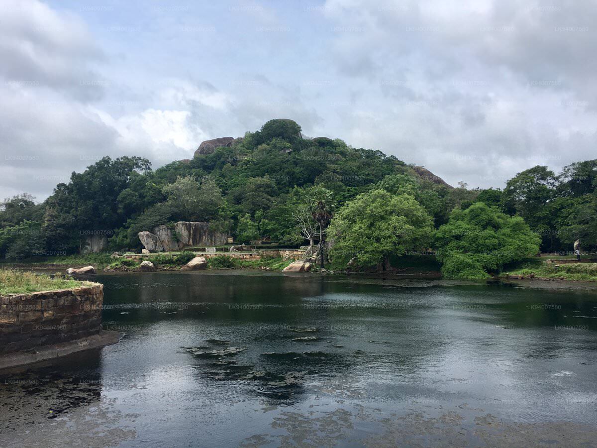
Die archäologische Waldstätte Kaludiya Pokuna ist ein Wald mit archäologischen Überresten in Kandalama in der Trockenzone Sri Lankas. Die Stätte wurde im Rahmen des von der Abteilung für Archäologie organisierten „Urumaya Thani Nokaramu“-Programms der Girls' High School in Kandy übergeben. Zum ersten Mal in Sri Lanka wurde einer Schule die Obhut einer archäologischen Stätte übertragen.

Der Ort erhielt seinen Namen von einem Teich, der in der Antike dunkles Wasser hatte. Der Ort wurde erstmals im 2. Jahrhundert v. Chr. besiedelt. Zu den Überresten auf dem Gelände gehören Inschriften, Wohnhäuser und ein Kloster.

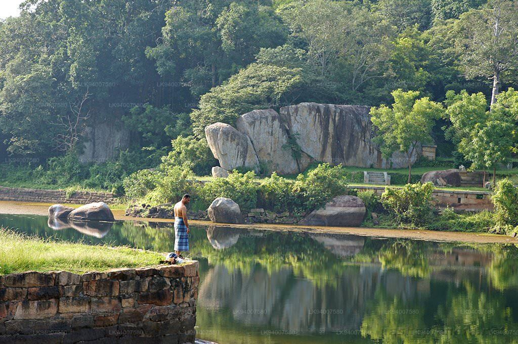
Kaludiya Pokuna ist außerdem reich an zahlreicher Artenvielfalt, sowohl in der Flora als auch in der Fauna. Der Wald ist die Heimat vieler endemischer und nicht-endemischer Arten von Flora und Fauna, die viel sicherer vorkommen als andere Wälder in Sri Lanka.

Das Gelände ist im Norden, Osten und Westen von Ackerland und menschlichen Siedlungen umgeben, wird jedoch nicht von Menschen gestört und die Primaten werden nicht versorgt. Es gibt keine Hinweise darauf, dass an dem Standort Jagd, Holzgewinnung oder Holzfällerei stattgefunden haben.

【LK94007580: Text von Lakpura™. Bilder von Google, Urheberrechte liegen bei den Originalautoren.】

About Matale District

Matale is a town in the hill country of Sri Lanka. The Knuckles Mountain Range is a special landmark of Matale.The Matale administrative district also contains the historic Sigiriya rock castle, Aluvihare Temple and Dambulla Cave Temple . Surrounding the town are the Knuckles foothills called Wiltshire. It is a mainly agricultural area, where tea, rubber, vegetable and spice cultivation dominate.

The Aluvihare Temple, on the North side of the town, is the historic location where the Pali Canon was first written down completely in text on ola (palm) leaves. Situated near Aluvihare are numerous monastery caves, some of which exhibit fine frescoes.

About Central Province

The Central Province of Sri Lanka consists primarily of mountainous terrain. The province has an area of 5,674 km², and a population of 2,421,148. Some major towns include Kandy, Gampola (24,730), Nuwara Eliya and Bandarawela. The population is a mixture of Sinhalese, Tamil and the Moors.

Both the hill capital Kandy and the city of Nuwara Eliya are located within the Central Province as well as Sri Pada. The province produces much of the famous Ceylon tea, planted by the British in the 1860s after a devastating disease killed all the coffee plantations in the province. Central Province attracts many tourists, with hill station towns such as Kandy, Gampola, Hatton and Nuwara Eliya. Temple tooth or Dalada maligawa is the main sacred place in Centrel province.

The climate is cool, and many areas about 1500 meters often have chilly nights. The western slopes are very wet, some places having almost 7000 mm of rain per year. The eastern slopes are parts of the mid-dry zone as it is receiving rain only from North-Eastern monsoon. The Temperatures range from 24°C at Kandy to just 16°C in Nuwara Eliya, which is located 1,889 m above sea level. The highest mountains in Sri Lanka are located in the Central Province. The terrain is mostly mountainous, with deep valleys cutting into it. The two main mountain regions are the central massif and the Knuckles range to the east of Kandy.