
Batticaloa-Lagune


Dieser Artikel handelt von der Lagune in der Ostprovinz in Sri Lanka. Für andere Verwendungen siehe Batticaloa (Begriffsklärung).
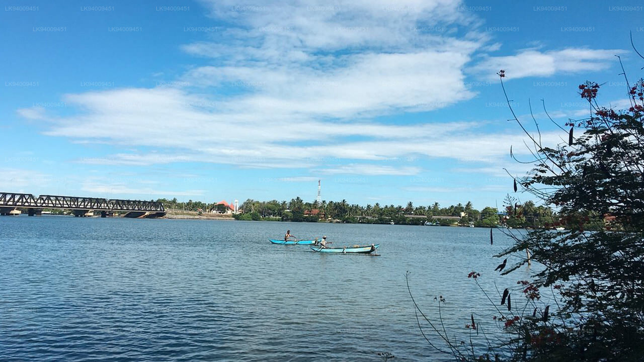
Die Batticaloa-Lagune ist eine sehr große Mündungslagune im Distrikt Batticaloa im Osten Sri Lankas. Die Stadt Batticaloa liegt an Land zwischen der Lagune und dem Indischen Ozean. Der Bezirk Batticaloa ist reich an drei Lagunen, nämlich der Batticaloa-Lagune, der Valaichchenai-Lagune und der Vakari-Lagune. Unter ihnen ist die Batticaloa-Lagune die größte Lagune im Distrikt Batticaloa. Die Batticaloa-Lagune ist eine lange und schmale Lagune an der Ostküste Sri Lankas mit einer Gesamtfläche von etwa 11.500 Hektar Wasser.
Die Lagune ist 56 km lang. Diese Lagune erstreckt sich von Eravur (Bezirk Batticaloa) im Norden bis Kalmunai (Bezirk Ampara) im Süden. Diese Lagune mündet an zwei Stellen ins Meer. Einer befindet sich am südlichen Ende der Lagune bei Kallar und der andere auf halber Höhe der Lagune bei Palameenmadu, in der Nähe der Stadt Batticaloa. Beide sind schmal und etwa 200 m breit. Die Breite des Wasserflusses an ihren Öffnungen variiert je nach Jahreszeit. Während der Trockenzeit nimmt die Breite der Lagunenmündung ab und schließt sich allmählich mit dem Einsetzen des Nordostmonsuns, der die Sandbank am Ende der Trockenzeit auftürmt. Später mit dem Regen und bei geschlossener Lagunenmündung.
Die Lagune wird von mehreren kleinen Flüssen gespeist. Es ist durch zwei schmale Kanäle mit dem Meer verbunden, einer bei Batticaloa und der andere bei Periyakallar. Während der Trockenzeit sind diese Kanäle durch Sandbänke blockiert.
Die Lagune ist von einer dicht besiedelten Region umgeben, in der Reis, Kokosnuss und andere Feldfrüchte angebaut werden. Das umliegende Land wird für die Garnelenzucht und den Reisanbau genutzt.
Die Lagune verfügt über ausgedehnte Mangrovensümpfe und einige Seegraswiesen. Die Lagune lockt eine große Vielfalt an Wasservögeln an.


Explore Eastern Province
-
Gal Oya Lake Club, Galoya
Normaler Preis Von €97,95 EURNormaler PreisStückpreis pro -
Kumana-Nationalpark-Safari ab Pottuvil
Normaler Preis Von €97,95 EURNormaler PreisStückpreis pro -
Kumana-Nationalpark-Safari ab Panama
Normaler Preis Von €82,95 EURNormaler PreisStückpreis pro -
Private Safari im Kumana-Nationalpark
Normaler Preis Von €82,95 EURNormaler PreisStückpreis pro


